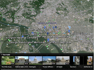
The KML File stands for "Keyhole Markup Language," it allows you to take a map created through Google Map and insert it into Google Earth providing a clearer aspect of the geographic data entered. The KML File will allow you to plot multiple points of interest, draw lines and mark regions within the file to transfer, allowing you to share places and information of other applications and exchange it to another.
Scavenger Hunt of Capital Cities!
When reviewing the Google Earth for Educators Website, I did come across some really great ideas of how to incorporate Google Earth successfully into the classroom. One that really caught my eye was the scavenger hunt, what student does not love a scavenger hunt?? The reason I chose this one particularly is because not ever really being attracted to history class, this would catch my interest and foresee it catching other students interest as well. It allows the students to research the cities, learning facts about each state and ultimately finding the answer by using Google Earth and seeing it geographically, almost putting them there at the actual capital. I think this activity would really grab a lot of students attention, and would be a lot of fun to do! You can locate this activity on this website: http://sitescontent.google.com/google-earth-for-educators/classroom-resources/lesson-plan-library.
Look at the list of lesson plans and click on: History, Scavenger Hunt of Capital Cities, 5- it will then upload a Microsoft Word Document and give further instructions.
ISTE Standards: 1a, 1b, 2a, 4a- These standards involve teachers using new technology and integrating it into the classroom to teach and educate students on new concepts and skills, then assessing them on the demonstration and understanding of the assignment given.


No comments:
Post a Comment